
AI-Powered Disaster Preparedness with SAADAAL Early Warning Platform
In recent years, communities in the region have experienced both extreme drought and devastating flooding resulting in repeated threats to lives and livelihoods demanding an advanced technological solution to safeguard the most vulnerable population. The severe effects of the heavy rain during the Gu season of 2024 have been highlighted in recent reports including this one from ReliefWeb, which estimates that more than 124,150 people have already been impacted directly. Aside from that, locust infestations caused by unusual weather patterns have made food insecurity and economic instability even worse throughout the region. These compound crises emphasize the critical need for reliable early warning systems like SAADAAL, which processes data from multiple sources, using public API’s and using cutting-edge artificial intelligence (AI) tools provide analysis and forecast to notify communities of impending threats.
What is SAADAAL?
Developed and supported by Shaqodoon under SomReP, the SAADAAL Early Warning System (forecast in Somali) introduces an innovative tool that improves preparedness and response to natural disasters including drought and floods.
How Does It Work?
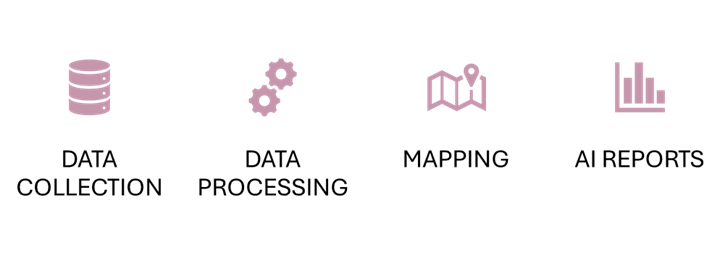
Figure 1: System Workflow.
The system utilizes a systematic approach to improve disaster preparation and response. Crucial to the operation is the collection of information from sources that are reliable, followed by advanced processing of information to assure accuracy. The data is then visually represented through mapping and critical insights are communicated to enable timely alerts. Additionally, the system creates detailed reports and uses AI data interpretation to predict and mitigate potential disasters, demonstrating its robust capabilities in managing and responding to environmental threats.
Data Collection
Before the system can begin its operation, it must first collect the right environmental data from reliable sources like FSNAU, ICPAC, and FAO SWALIM. This data includes vital metrics that are each essential for the effective monitoring of potential triggers of natural disasters, such as river flooding levels, and rainfall forecasts.
1. FAO SWALIM - Water and Land Information Management for Somalia - Food and Agriculture Organization
In order to evaluate flood risks and challenges with water scarcity, FAO SWALIM provides essential data on land and water management. With SWALIM, SAADAAL can obtain:
Essential Hydrological data for managing water resources and forecasting floods, by measuring the water levels and flows in rivers.
Data on land use and soil erosion is also used to understand and determine how vulnerable a region is to floods and how it might affect agriculture.
2. ICPAC (IGAD Climate Prediction and Applications Centre)
In the greater Horn of Africa, ICPAC plays a significant role in climate monitoring and forecasting by offering:
Short and long-term seasonal climate predictions which are useful in anticipating weather conditions that may cause flooding.
Data on information and rainfall patterns which are crucial for forecasting events that may trigger natural disasters.
3. FSNAU (Food Security and Nutrition Analysis Unit - Somalia)
FSNAU makes the following contributions to the system through Normalized Difference Vegetation Index (NDVI) and Combined Drought Index (CDI):
Agricultural data, such as yields and crop cycles, are crucial for determining how environmental factors affect the production of food.
Reports on nutrition and food security that aid in determining how possible environmental changes may affect people and direct humanitarian efforts to provide food assistance and nutritional interventions.
High-Resolution Mapping
1. Rainfall

Figure 2: SAADAAL Dashboard Depicting Rainfall Amount by Location.
SAADAAL’s mapping functionality displays the AI assisted processed data, on maps that are high-resolution and color-coded. The rainfall data section shows actual rainfall from the previous month and compares it to the long-term or medium average from the same period. Historical rainfall data over a 30-year period provides a comprehensive baseline for understanding long-term trends and variations in specific regions and districts. The platform then indicates whether there has been a change in amount through color-coded indicators. Combined with other indicators, this provides government officials monitoring the platform with data to make relevant decisions.
This tool enables stakeholders – including government agencies like the Ministry of Humanitarian Affairs and Disaster Management and the Somali Disaster Management Agency (SODMA) to swiftly assess and respond to emerging threats. By integrating data from these varied sources, SAADAAL ensures that all parties involved have access to accurate, up-to-date information that is crucial for making informed decisions during disastrous situations. The collaborative efforts of other stakeholders – including international organizations like FAO, SWALIM, ICPAC and FSNAU, as well as Telecom companies, are essential in leveraging technology to enhance disaster preparedness and response in Somalia.
2. Rainfall Forecast

Figure 3. SAADAAL Dashboard Depicting Weekly Total Rainfall Forecast.
The map highlights southwest state and district borders. The data is fetched from ICPAC east Africa hazard watch which uses multiple models and satellites to determine weather forecasts for the next seven days. The colors on the districts show measurement in millimeters of rainfall predicted. This forecast is released every Tuesday. The source of the is from ICPAC WRF forecast driven by global forecast from Climate Forecast System (CFS).
3. River Flooding

Figure 4. SAADAAL Dashboard Depicting Main River Flooding in the Selected Region.
Water levels at seven stations can be tracked by clicking their markers on the map. The markers change color to indicate risk: GREEN for normal, ORANGE for moderate, LIGHT RED for high, and DARK RED for full capacity. The Jowhar station on the Shabelle River may affect the Afgoye district. Similarly, the Luuq station on the Jubba River could impact the Qansaax Dheere district.
4. Combined Drought Index

Figure 5. SAADAAL Dashboard Depicting Combined Drought Index for April 2024.
The Combined Drought Index (CDI) utilizes a color-coded system to convey the severity of drought conditions in an easily understandable way. The colors correspond to different levels of drought severity:
Green indicates a CDI equals or greater than 1.0, meaning the region is experiencing normal to above-average moisture levels—there is no concern for drought here.
Yellow marks a CDI between 0.8 and 1.0, signaling that the area is beginning to see below-normal moisture levels, which could be cause for minor concern if the trend continues.
Red denotes CDI below 0.8, representing moderate to extreme drought conditions; this is an urgent indicator that the area is significantly drier than normal, with potential repercussions for water supply, agriculture, and the ecosystem.
5. Vegetation Health Cover

Figure 6. SAADAAL System Depicting Vegetation Health Cover for April 2024.
NDVI uses satellite images to monitor plant health by comparing reflected near-infrared and absorbed red light. It scores from -1 to +1, with higher scores indicating lush vegetation. NDVI readings with a slight decrease (less than 0.05) or any increase are normal (GREEN). A moderate decrease (0.05 to 0.125) triggers an alert (YELLOW), and a significant drop (more than 0.125) signals an alarm (RED), indicating potential issues with plant health.
INTELLIGENT REPORTS AND AI DATA INTERPRETATION
SAADAAL utilizes generative AI technology to generate extensive reports that summarize environmental conditions and projections. These reports are designed to empower government officials to provide clear, actionable information to communities at risk, enables them to plan effectively in the event of an upcoming disaster and provide aid agencies information to provide timely support.
The use of AI in data analysis and report generation provides several critical advantages that significantly enhance the systems’ efficiency and effectiveness.
WHY AI?
AI tools are employed in SAADAAL for several key reasons:
Efficiency and speed: AI algorithms can process large volumes of data quickly and consistently, reducing the time required for analysis compared to manual methods previously used. This rapid processing capability is essential for timely decision-making during emergency situations.
Predictive accuracy: AI excels in identifying patterns and trends that may not be immediately apparent to human analysts. This enhances the predictive capabilities of the system, allowing for more accurate forecasts and proactive disaster management.
Consistency: By automating the data analysis process, AI ensures that the information is processed using the same criteria and methods every time, greatly reducing the risk of human error and subjective bias.
Accessibility of information: AI-generated reports are structures to be easily disseminated and accessed by various stakeholders, providing real-time insights that are crucial for effective and timely decision-making.
Contrast with Previous Systems (MEWS-NADFOR):
The previous MEWS-NADFOR system lacked the capability to automatically generate reports which resulted in several issues:
Manual Report Generation: Staff-generated reports were time-consuming and prone to errors. The process often mixed relevant and irrelevant information, leading to confusion and inefficiency.
Resource constraints: There was a significant strain on resources, as the system required continuous monitoring by staff who had to manually collate and make sense of data from multiple platforms.
Speed and responsiveness: The inability to quickly process and report data meant that responses to environmental threats were often delayed, reducing the effectiveness of disaster response efforts.
Enhancements with SAADAAL:
In contrast, SAADAAL leverages AI to overcome these challenges, ensuring automated data collection and analysis. This results in:
Real-time reporting: Immediate generation and dissemination of reports enable quicker response times.
Enhanced Data Integration: The System seamlessly integrates data from various sources, providing holistic view of environmental situations.
Interactive Maps: These maps display different indicators such as rainfall, drought, vegetation health, and river flooding, enhancing the visualization of data and making it easier for stakeholders to interpret and act upon the information.
PROACTIVE INFORMATION DISSEMINATION
The insights gained from SAADAAL’s analysis are quickly disseminated through the IMAQAL Voice Broadcast Platform, an integral component of the System’s communication strategy. This platform utilizes an Interactive Voice Response (IVR) System to ensure that messages reach the registered communities promptly and effectively.
Registration and User Management:
Communities are registered into the system through contact phone numbers. The IMAQAL platform features two user interfaces:
Admin User
Client User

Figure 7: IMAQAL Voice Broadcast Platform Dashboard
Telecom Integration and Message Delivery:
The platform is integrated with major Somali telecommunications companies such as Telesom. Hormuud and Somtel, ensuring widespread coverage and reliable message delivery. integration is crucial for maintaining a robust connection across diverse geographical areas, enabling the system to reach a broad audience quickly.
Message preparation and Broadcasting:
Messages are prepared by recording audio, which is then uploaded and formatted appropriately. The typical format used is WAV for audio files, ensuring high-quality sound. Messages are scheduled for broadcast, and once approved by an admin user, they are disseminated swiftly – typically within minutes of approval.
Speed of Broadcasting and Audit Trails:
The broadcasting process is designed for speed to ensure timely alerts. All broadcasts are logged with audit files that record details such as the timestamp, message name, telephone number, language of the message, message duration, call duration, and the percentage of the broadcast's reach. This meticulous record-keeping is essential for monitoring the system's effectiveness and making necessary adjustments.
Ensuring Effective Communication:
The quick and efficient dissemination of information via the IMAQAL platform is crucial for community preparation, enabling timely evacuation and allocation of resources in anticipation of possible disasters. By leveraging this advanced technological solution, SAADAAL not only enhances the area's readiness for disasters but also showcases the region’s adaptability in using new technologies for disaster management.

Figure 8: Technical Process of Information Flow and Dissemination.
MULTIFUNCTIONAL SYSTEM CAPABILTIES
Beyond its primary functions, the SAADAAL platform is integrated with international weather forecasts and Shaqodoon’s voice broadcast platform, which in turn is connected with major Somali telecom operators. This integration facilitates the cross-verification of meteorological data with AI-analyzed reports, enabling swift communication to registered community members in risk-prone districts. Currently, SAADAAL is monitoring only the Southwest State of Somalia as part of its pilot rollout phase. This strategic focus allows for targeted enhancements and adaptations based on initial feedback and performance metrics.
The system has recently incorporated several new features and integrations that further its reach and functionality. These integrations include:
IMAQAL Voice Broadcast Platform: A critical update has been the integration with the IMAQAL Voice Broadcast Platform. This platform enhances the system’s ability to communicate alerts efficiently through Interactive Voice Response (IVR) technology, ensuring that messages reach a wide audience quickly and effectively.
Telecom Partnerships: to expand its reach, SAADAAL has partnered with major telecommunications companies in Somalia, such as Telesom, Hormuud, and Somtel.
Enhanced Data Sources: The system has improved its data integration capabilities by linking with international weather forecast sites and local data providers, providing comprehensive and up-to-date environmental data.
Upcoming System Upgrades:
Farmer Integration (EU Riverine Project): Plans are underway to link the EWS with the M Dalag system, which will provide farmers with essential market information and connect them to market opportunities through IVR and SMS. This integration is aimed at enhancing the economic resilience of the agricultural sector.
GIS Enhancements: Future updates include improved spatial analysis using Geographic Information Systems (GIS) to assess infrastructure vulnerability and provide detailed visual reports, which will aid in more precise disaster preparedness and response strategies.
Automated Audio Message Generation: Developing features to automatically generate audio messages for alerts will improve accessibility for non-literate community members, ensuring that vital information is communicated clearly and promptly.
Auto-Translation of Reports: Implementing automated translation of AI-generated reports from English to Somali will ensure that all community members have access to understandable and actionable information.
These multifunctional capabilities demonstrate SAADAAL’s commitment to using cutting-edge technology to improve disaster management practices. By continually updating and integrating new features, the system remains at the forefront of innovation in early warning and disaster response technologies.

Figure 9: Shaqodoon Team Presenting System to SWS Ministry of Humanitarian Affairs and Disaster Management.
On April 24th, 2024, Shaqodoon Organization and Somali Resilience Programme (SomReP) convened in Baidoa to train relevant staff from the Southwest State Ministry of Humanitarian Affairs and Disaster Management on the operationalization of this beta version of the SAADAAL Early Warning System. Key stakeholders gathered, among them Minister Abdinasir Abdi Arush who commended the system for its user-friendly interface, which aligns perfectly with the ministry’s goals.
The presence of Kamal Farah from CARE International and Mohamed Anoy from World Vision – SomReP consortium members – provided a united front in the disaster preparedness initiatives.

Figure 10: Members of SOMREP and Ministry at the Handover Event in Baidoa.
During the ceremony, Mr. Mohammed Adde Bashir, Director General at the Ministry commended the SAADAAL Early Warning System for its innovative approach to disaster preparedness. He recognized the potential of the system to improve the area’s response capabilities and made helpful recommendations to optimize its performance.
The transfer event ceremony included practical training, following an initial virtual training session that provided local participants with the essential knowledge and skills to maximize the capabilities of the system. The agenda covered a wide range of topics, from the interpretation of data and navigation of the system to decision-making based on early warning indicators. “We are committed to continually enhancing the system’s capabilities and customizing it to better meet the needs of MoHADM. The future holds promising advancements for SAADAAL, as we plan to incorporate more features and extend its reach.” Hannan Ibrahim Technology and Innovation Support at Shaqodoon.

Figure 11: SAADAAL Action room at the MoHADM in Baidoa.

Figure 12: SAADAAL Action room at the MoHADM in Baidoa.
This event not only marked a significant milestone in AI powered, locally developed innovative tools contributing to the disaster preparedness of communities at risk but also opportunities to continue to pave the way for a profoundly positive influence on the communities most at risk for climate-related catastrophes. Recent years have seen significant floods, notably along the Juba and Shabelle Rivers, which have been worsened by climate change. The SAADAAL System has the potential to contribute to completely transforming how communities in the Southwest of Somalia regions react to and prepare for environmental threats. By providing early warning and facilitating swift action, the system is anticipated to considerably lower the risks connected with extreme weather events and environmental changes. Furthermore, the proactive measures made possible by this system will support sustainable development within impacted areas, promoting long-term resilience.
At Shaqodoon, we remain committed to the cause of technology and innovation for development and humanitarian purposes. Our attitude towards disaster preparedness provides a safer and more resilient future for the communities in the Horn. As the challenge presented by climate change develops, innovative tools become increasingly crucial in protecting communities and property against natural disasters.